Map 14
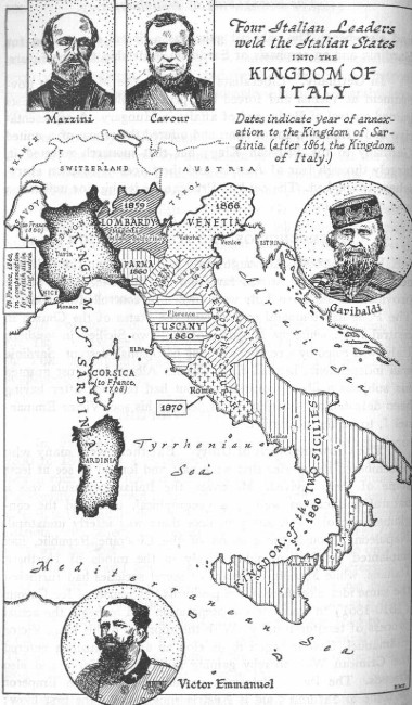
Map number 14: This is it! -- the end of the Papal States! Although the States of the Church appear on this map of central Italy, they are only delineated there to show what dates they were permanently taken from the Papacy. Italian unity was effected during the period 1848 to 1870. Portions of the Papal States were lost in 1848; the largest part was lost in 1860 as shown on this map, and the portion around Rome was finally taken in 1870 by invading Italian armies, which the Pope's armies fought with cannons, yes cannons, until the Italians under Victor Emmanuel, had breached the walls of Rome. This is described in detail in the chapter on the Pouring out of the Bowls